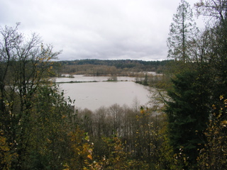
I'm in the edge of the plateau that Arlington Heights sits on, below me are some farmers' fields, and the town of Arlington is on the distant hill. Between us lies the south fork of the Stillaguamish River. It is usually a thin ribbon through the valley below... it has now BECOME the valley below!
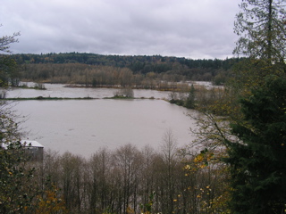
You can see the normal course of the river just past the trees in the middle of the frame.
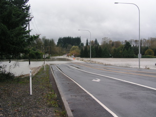
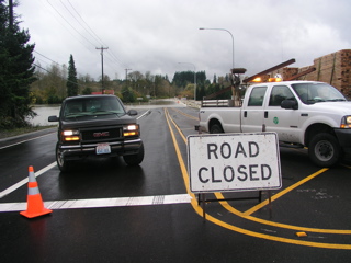
WA SR 530 at Twin Rivers park just north of Arlington. I'm stranded at home, and my kids are stranded at school. My wife is up in Mt. Vernon, so at least she'll be able to pick up the kids, but won't be home until who knows when.
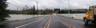
Panorama shot of the closed section of SR530 just north of Arlington.
The Fire Dept and DOT have closed SR530 AND Jordan Road (soth to Granite Falls. Our only way in and out right now is SR530 east through the mountains to Rockport, then SR20 down to Mount Vernon... a trip of 100 miles.